Freeman Village
History:
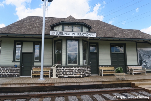
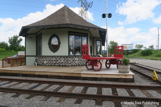
Freeman is named after Joshua Freeman Sr., who settled here in 1818. The Freeman homestead was situated at the northeast intersection of Brant Street and Plains Road. Joshua and Elizabeth Freeman had 14 children. There descendents continued farming this land well into the 1900s. Not surprisingly the community took on the name Freeman’s Corners and later the Village of Freeman. Freeman became well known for its market gardens that were operated by a number of pioneer families, most of whom hailed from England. These farmers took advantage of the rich and fertile soil in the area and produced an abundance of fruit and produce. It was perfect symmetry that a Great Western Railway station opened in Freeman in 1850. The station was called Burlington Junction but was known locally as Freeman Station. The arrival of the railway allowed Freeman’s produce to be shipped across Canada. The railway also spurred on more industry in Freeman including: a pickle factory, a brickyard, a chemical factory, a canning factory and a basket factory. The Freeman post office opened in the Freeman general store in the mid 1800s. The Freeman postmark continued to be used until 1952 when the name changed to Burlington. By this time development was encroaching on Freeman’s doorstep and by the 1960’s the old village of Freeman had mostly been relegated to the pages of history. I say mostly because one very important landmark survived and that is the Freeman Station. It now stands at 1285 Fairview Street as a proud reminder of this neighbourhoods past and a symbol of renewal for today’s Freeman neighbourhood.
Overview:
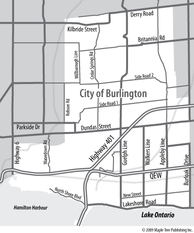
Freeman is situated in the middle of Burlington just north of Downtown Burlington. It is somewhat isolated from the rest of Burlington by the highways and industrial lands that surround it. Highway 403 forms the northern boundary of the neighbourhood while the Burlington Go Station and an industrial corridor forms the south end of the neighbourhood. The historic Freeman Station located at 1285 Fairview Street is a neighbourhood landmark and icon that connects the old neighbourhood with the new.
Lifestyle:
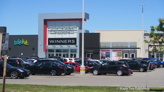
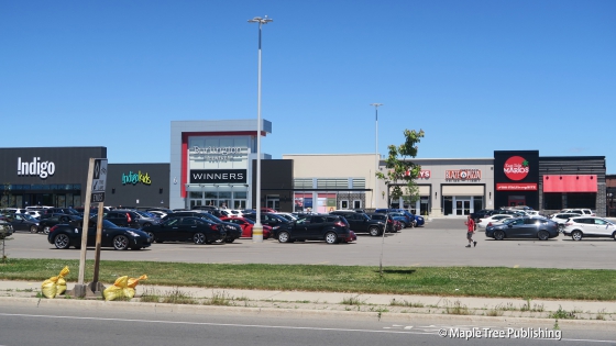
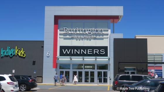
Burlington Centre situated on the eastern edge of Freeman Village at 777 Guelph Line is a popular regional shopping destination that features retail and restaurants on the main floor and professional and medical offices on the second floor.
Homes:
There is a little bit of everything here when it comes to housing including ranch bungalows, split-level houses townhomes and neo-colonial detached houses. The streetscapes are well-treed, and relatively quiet with homes well setback from the street.
Recreation:
There are two neighbourhood parks that bookend this neighbourhood. Leighland Park on the west has a children’s playground, basketball court, tennis courts and a baseball diamond. Queensway Park on the east has a children’s playground.
Arts:
The Art Gallery of Burlington is located at 1333 Lakeshore Road in the heart of Burlington’s downtown waterfront. This contemporary gallery is a multi-faceted centre that is the home base for 7 different artists guilds operating within the City of Burlington. The AGB also provides studio space for local artists, as well as hosting a myriad of exhibitions, lectures and events and running school programs. The AGB is especially known for its ceramic collection.
The Burlington Performing Arts Centre is a city landmark and source of civic pride. This landmark centre occupies a high profile position in the downtown core at the corner of Locust and Elgin Streets. The Burlington Performing Arts Centre is comprised of two theatres; the larger Main Theatre has world-class acoustics and an orchestra pit. It is ideal for theatrical and musical performances and seats 718 people. The more intimate Community Theatre is ideal for smaller scale productions. It seats 225 people.
Freeman Village Stats
Walkability:
Low
Bikeability:
Low
Public Transit:
Medium
Affordability:
Medium
Greenspace:
Low
Recreation:
Medium
Legend: Low, Medium, High
Commute Times
* All commuting times provided are approximate times only. Commute times may increase or decrease depending on where you live within the neighbourhood and the time of day i.e rush hour versus off hour commutes. Time estimates to public transit are based on walking distance or bus line connection whichever is quicker. All other commute times on the chart above are based on drive times.
